
Warksmoor becomes Newtown
Prior to the 19th-century industrialisation of the district that was to become Newtown it was known by its ancient name of Warksmoor, which was situated in the township of Disley.
It was principally a rural area with pastures leading down to the river Goyt. To the west was Potta Hey (aka Potters Hey or Knathole) Wood, which was over 17 acres in extent, and to the east was the smaller Warksmoor Wood.
The Tithe Map Apportionment for 1851 records that the landowner at Warksmoor was John William Jodrell and the occupiers to the south of the Peak Forest Canal were Jordan Bradbury and Martha Midworth and to the north
they were James Kelsall and Charles Yates.
At this time, the old Redmoor Ln through Warksmoor extended over the canal to join the towpath. A short distance to the west of Redmoor Ln was the turnpike to Hayfield (from the Manchester and Buxton turnpike) that opened in 1835. The turnpike bridge over the canal was built in 1834 and initially it was called Thornsett Road Bridge but later this was changed to Albion Road Bridge to reflect the name of the turnpike through Warksmoor. The date of the demolition of the canal bridge at the bottom of Redmoor Ln is unknown but the Ordnance Survey map for c.1875 shows that it was no longer extant by this time. Redmoor Ln was connected to Albion Road by the short Hibbert Street.
In the third quarter of the 19th century, the neighbourhood around Albion Road Bridge became the location for the canal-side development of cotton mills that were supported by the millwright and engineering firm of John Hawthorn & Company whose Canal Foundry was in business by the 1870s. Two rope walks were built for the manufacture of rope that would be used for power transmission purposes in the mills. Other local uses for rope would have included coal mining and for hauling boats along the canal. Twine was also manufactured for uses such as operating sash windows. One rope walk was located to the north of Brunswick Mill and the other to the south of Warksmoor Wharf, the latter being known as the Newtown Ropery, founded by John Harrop.
The Distance Table for the Peak Forest Canal, published in 1888, provides an insight into the scale of industrialisation that had occurred by this time. The distances given refer to the start of the canal at
Ashton Junction in Dukinfield,
(1 chain = 22 yards):
In 1857 the Stockport, Disley and Whaley Bridge Railway Company opened its line between Stockport Edgeley and Whaley Bridge and Newtown Railway Station, sidings and a goods shed were provided on the east side of Albion Road, a short distance away from the mills. In 1863 the line was extended to Buxton and in 1866 the railway company was succeeded by the London and North Western Railway Company.
During the 20th century, the cotton industry declined and the mills were put to new uses. The confectionery firm of Swizzels Matlow moved into Brunswick Mill and the light-engineering firm of Mini Gears moved into Albion Mill but subsequently Mini Gears moved to Heaton Mersey, Stockport.
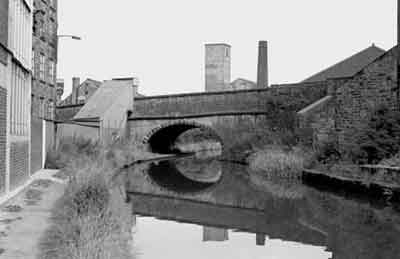
The approach to Albion Road Bridge (formerly Thornsett Road Bridge) looking east, Newtown, Aug 1978.
Brunswick Mill is on the left and Albion Mill is on the right.
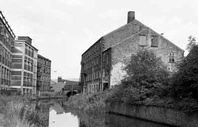
Albion Road Bridge looking east, Newtown, Aug 1978.
Brunswick Mill is on the left and Albion Mill is off the picture on the right. Canal Foundry is beyond the bridge on the left and Victoria Mill stands next to it in the background.
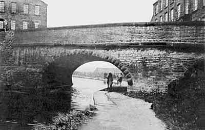
Albion Road Bridge looking west, 1930s.
This bridge dates fron 1834 and it is 12 miles from the start of the Peak Forest Canal at Ashton Junction, Dukinfield.
Brunswick Mill is on the right and Albion Mill is on the left.
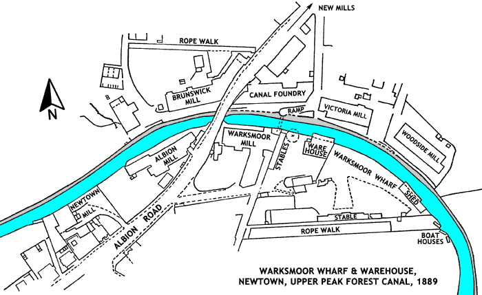
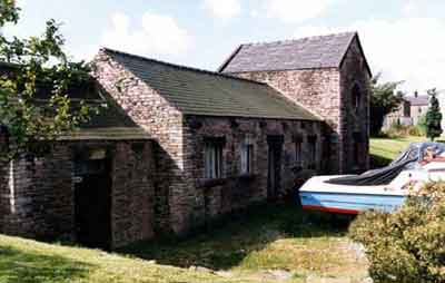
The Peak Forest Canal Company's Warksmoor Wharf and Warehouse, Newtown, 1970s.
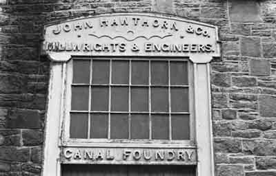
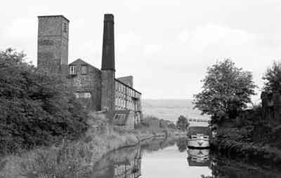
Canal Foundry, Newtown, Aug 1978.
Established by John Hawthorn, this foundry stands on the towpath side of the canal by Albion Road Bridge. It is known that it was in existence by the 1870s.
The window and lintel over the Albion Rd entrance to Canal Foundry, Aug 1978.
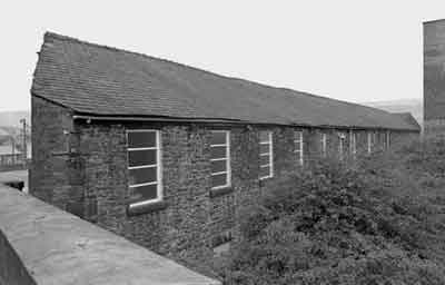
Victoria Mill looking west, Newtown, 1960s.
This mill was built in 1860 and when it closed in 1985 it was the last cotton spinning mill working in Newtown. There was a disastrous fire here on the 13 Mar 1986.
Victoria Mill looking east from Albion Road Bridge, Newtown, Aug 1978.
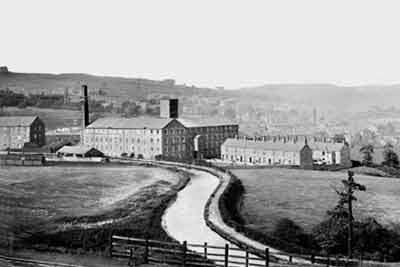
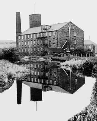
The Peak Forest Canal at Newtown, c.1910.
The mill, centre left, is Woodside Mill and this was burnt down in October 1961. The terraced cottages to the right of the mill are Hawthorn Bank (built in 1903) and Acorn Terrace (built in 1900). The two rows of cottages were provided for millworkers.
On the extreme left, part of Victoria Mill can be seen and in front of it, on this side of the canal, the very low building is the rope walk of Newtown Ropery. The shed alongside the canal, to the right of the rope walk, is situated at the eastern end of Warksmoor Wharf and it was provided for the transhipment of goods undercover to and from the canal.
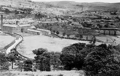
The Peak Forest Canal at Newtown, c.1910.
Woodside Mill and the two rows of cottages are on the left. The viaduct, centre right, carries the Midland Railway line over the river Goyt and beyond it, to the left, another viaduct carries the Hayfield turnpike over the river. Here the name changes from Albion Rd to Church Rd.
