
Plot details for the Tithe Map record the site of Ridge Quarry as the ‘Stone Quarry On The Ridge’, the landowners being recorded as the ‘Landowners of Marple’. The smaller quarry by the canal was recorded as the ‘Little High Piece’ and the landowner in 1850 was Peter Arkwright, who succeeded his father, Richard Arkwright Jr, and Samuel Oldknow. The site of the coal shaft, between Hollinwood Ln and the Upper Peak Forest Canal was recorded as ‘Pye Greave & Hollinwood’ and the landowners were the Executors of Joseph Johnson.
Ridge Quarry is now a small area of woodland consisting mainly of birch and oak known as Ridge Quarry Wood.
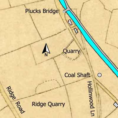
Ridge Quarry
Upper Peak Forest Canal
Grid Ref: SJ 965 868
Tithe Map: 1850, Ref: EDT 262/2
Courtesy: Cheshire Archives & Local Studies