
Lock 6 pound
With rises varying from 12 feet 7 inches to 13 feet 6 inches for each lock, Marple locks are among the deepest on the narrow canal system in Britain. As a consequence, it was understood at the planning stage that methods of
providing an adequate water supply and storage were required. Each time a boat boat passes through the Marple flight it uses around 43,895 gallons (UK) of water.
The locks were placed relatively close together and as a consequence the pounds were too short to function as reservoirs. This issue was overcome by making the pounds much wider than was required for navigation purposes in order to increase their water storage capacity. This widening is most noticeable towards the top of the flight between locks 13 and 16, which were constructed wider on the east side. The two pounds between locks 13 and 15 were bulbous shaped while the pound between locks 15 and 16 was long and narrow in the shape of a sickle. Interestingly, the by-wash (or overflow) around lock 16 was channelled into the head of this widened pound.
Referring to the Tithe Map of lock 6 pound, it can be seen that it was locally widened at its southern end in order to increase its capacity. This was also constructed on the east side but in this instance the towpath was on the same side. The disadvantage of this arrangement was that while a boat was steering across the wide, the towing horse had to walk around its perimeter.
The Ordnance Survey map of c.1875 shows that at some point during the intervening 25 years that the towpath had been diverted across the wide to leave an isolated pond that remains to the present day and by 1904 this had become known as Willow Pond. An examination of this pond shows that no slippage of the ground seems to have occurred, so the rationale behind the diversion seems to have been one of improving efficiency.
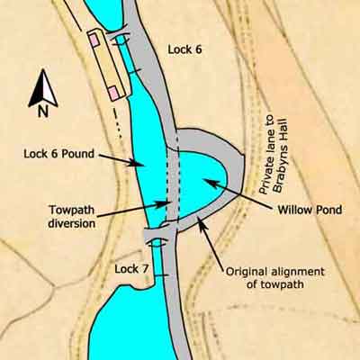
Lock 6 Pound, Marple Locks
Peak Forest Canal
Grid Ref: SJ 961 894
Tithe Map: 1850, Ref: EDT 262/2
Courtesy: Cheshire Archives & Local Studies
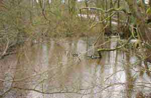
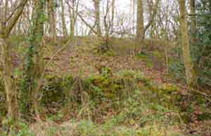
A view looking across Willow Pond, Mar 2008.
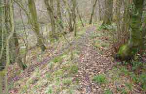
A view of the original towpath curving round to the right, Mar 2008.
The pond is off the picture on the right and the embankment supporting it is on the left.
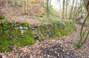
A section of the retaining wall at the foot of the embankment, Mar 2008.
Detail of the embankment with the retaining wall in the foreground, Mar 2008.
This view illustrates just how high the embankment had to be built in order to bring the land up to the level of the canal.
Overflow at Lock 6 Pound in 1904
The two memorandums below were written at the Marple Section Office on the 14 Dec 1904 and they describe how damage to Lock 9 caused the canal to overflow at the pound of Lock 6.
The water flowed over the towpath, which was low at this point, into Willow Pond on the other side of the towpath and then onto the driveway of Brabyns Hall, causing a little damage.
A sketch was also provided to show where the overflow occurred.
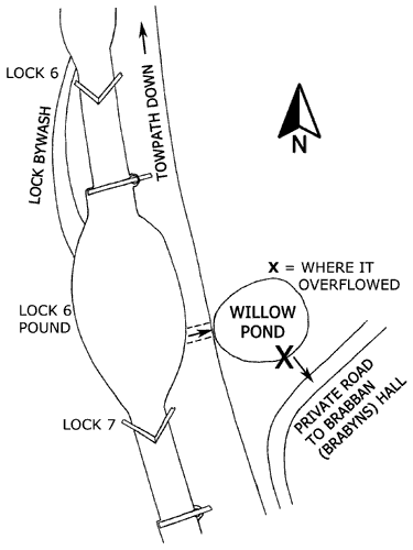
Sketch of the Overflow at Lock 6 Pound.
When Marple Locks were built, Willow Pond was part of the pound of Lock 6. Subsequently, the towpath was diverted across the pound to reduce its size and the isolated part of the original pound became known as Willow Pond. When this work was done the towpath was not built high enough and this was the reason why the pound overflowed at this point. Had it been built to the correct height then the flood water would have flowed safely away down the bywash of Lock 6 and into the pound of Lock 5.
In their time, both George Lucas and Raymond Potts Bagshawe were Canal Inspectors based at the Marple Section Office but in 1904 it seems that Mr Bagshawe was reporting to Mr Lucas. Mr Lucas was resident at Top Lock, Marple, and Mr Bagshawe was resident on Chadwick St, Marple, which is off Church Ln and close to Marple Locks.
